SLALOM is a GIS informative system for supporting decision makers and operators within the management of sport events. SLALOM is a user-friendly tool designed for all kinds of users

SLALOM is a modular plug and play system and comes with tools for binding to TETRA, civil smart-phones, and real-time data-sources

SLALOM is a novel web application, users log from any device using their preferred Internet browser. Anywhere

Administrators can edit users permissions at runtime, the access to each system functionality and each managed asset can be restricted

SLALOM guarantees an enterprise security level, system uptime is higher than 5 nines (99.999%). Built on stable open source libraries
Fleet assets are tracked in real-time. Vehicles, portable radios, helicopters and drones are connected by means of TETRA or civil GPS devices

Beside real-time operations, SLALOM allow authorized users to browse, search and generate statistics on historical data

SLALOM analyzes GPS data for identifying different itineraries. No need of metadata, the system exploits space-time correlation of raw data

Flees assets, sensing equipments, live events are classified and grouped in dynamic hierarchical views. Map icons styling reflects the selected perspective
Tracked Devices
Positions in real-time
Active Users
Connected Sensors
SLALOM manage thousands of vehicles, radio, sensors and events in real-time
Each asset is classified by typology and provided attributes. SLALOM requires very few information about assets, but structured data are supported and exploited
Vehicular radios (e.g., TETRA) and Trackers
Handheld radios (e.g., TETRA)
Helicopeters, UAV, Drones
with SLALOM MOBILE App
SLALOM embeds live external data-sources and environmental sensing equipments distributed on the field. Sensors and live events are aggregated in different map layers
Information (data, charts, images, streams) are easily accessible within the interactive map
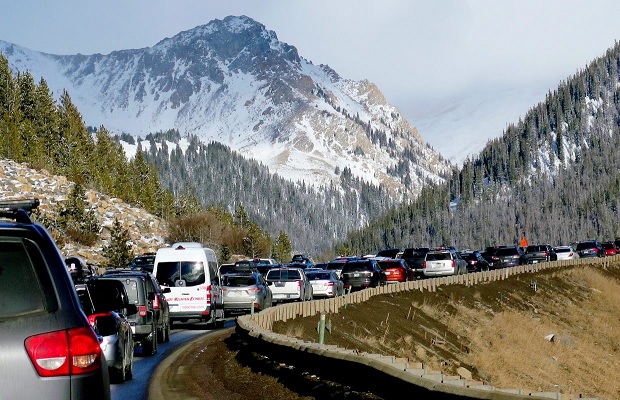
Closed roads, queues, road works and other traffic events are useful to the operators for routing vehicles and coordinating the fleet
Public security video-cameras and webcams are localized and the stream is integrated in the interactive map
Weather conditions and forecasts are a valuable for preventing, monitoring and managing emergencies. SLALOM managed thousands of sensors with real-time charts embedded in the map
SLALOM supports heterogeneous sensors and data for providing the best situation awareness to decision makers. Some sensors are Moisture meters, Rain gauges, hygrometers, Barometers, Radiometers
SLALOM is based on reliable, state-of-the-art technologies
Central servers run on any platform, including the Cloud